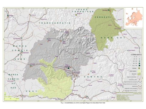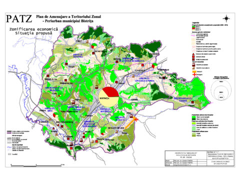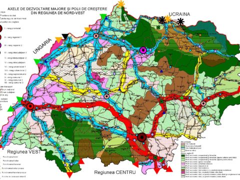
Reactualizare Plan de Amenajare a Teritoriului Judeţean – PATJ – Judeţul Maramureş [Update to the Maramureş County Spatial Plan]
Period: 2009
Beneficiary: Maramureş County Council
Project Manager: Professor Pompei Cocean
The spatial plan was based from the outset on a thorough analysis of the current state, a predominance of diagnosis scenarios, and extensive and complex prognoses of territorial development. Apparently framed in a previously established pattern (county level), Maramureş County stands out due to several particular features. Their rational management will be able to ensure a sustainable territorial development. Maramureş County is guarded by high mountain ranges, with diverse geological structures, and is consolidated on the bottom of several depressions (e.g. Maramureş, Târgu Lăpuş), which contain a mosaic of metalliferous and non-metalliferous mineral resources. It is drained by the tributaries of the Tisa and the Someş rivers and is characterized by a mountain climate, favourable for winter sports, and by a depression climate, favourable for settlements and for agricultural land use, as well as by some very rare fauna and flora species. Therefore, Maramureş County is characterized by a natural support highly favourable for socio-economic development. Moreover, the natural component has become a sine qua non condition for the assertion of the other territorial resources, both human and economic. The permanent interrelation between the natural factors and the human component is characterized by a high degree of inhabitation, the creation of specific habitats (see the individuality of villages!), cattle raising, the cultivation of plants suitable to the existing soil conditions, and the individualisation of several ethnographic mental areas.